 |
To the east of Agematsu Town stretches the Central Japan Alps range.
The highest peak is Mt. Kisokomagatake.
From Agematsu Town, Course A, Course B, and the Mt. Utsugidake Course are used to access the mountain.
Mt. Kazakoshi is also popular with day trip hikers recently.
On this page, we provide information to enjoy climbing in the mountains.
| Nagano Prefectural Regulations for Safe Mountain Climbing |
| Please read this for your safety when mountain climbing. Nagano Prefectural Government Website (Japanese) These regulations apply to Agematsu Course A, Agematsu Course B, and the Utsugidake Course. |
Summary of Nagano Prefectural Regulations for Mountain Climbing Safety For all climbers
|
Submission of a Mountain Climbing Plan
| If you are a group, only a single, representative person needs to submit the form. | Items to Fill-in
|
| The submission boxes are located at the following spots in Agematsu Town. (Click here to go to Google Maps) |
Agematsu Station Tourist Office (Image of a submission box) Agematsu Course A Trailhead Parking (Image of a submission box) Agematsu Course B Next to Kisokoma Hut Utsugidake Course Upper Kuramoto Community (Image of a submission box) |
![]()
Introduction of the Trails for Mt. Komagatake
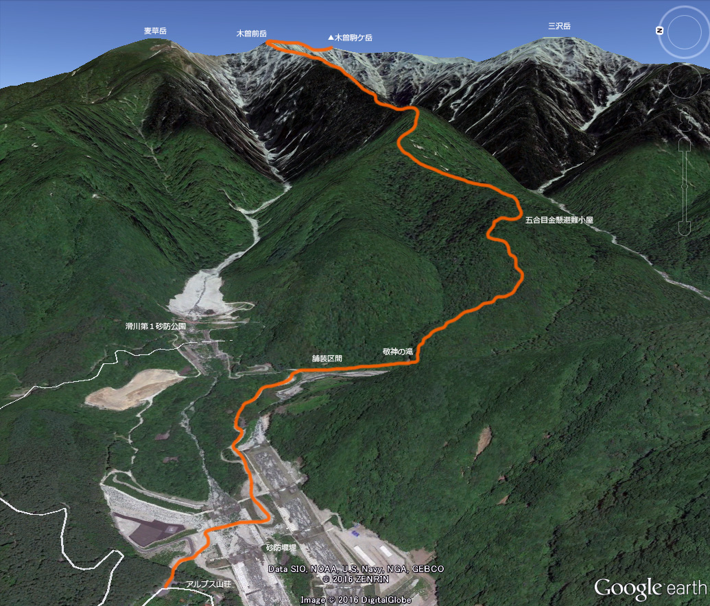
| Agematsu Course A for Mt. Kisokomagatake This is the main route from Agematsu Sta. to Mt. Komagatake via Mt. Kisomaedake . It became so popular, following Walter Weston’s use of the route, that there was once a busy bus service running here. It is an 8-km, 8-hour hike from the Alps Hut at the second station. Until Kanakake Refuge Hut at the fifth station, the path is rather steep. There used to be a water supply “Kongosui” at this fifth station, but it is now often dry. So, the last water supply should be at Keishin, the third station. There are no staff at Kanakake Refuge Hut, and anybody is free to use it. The Onagi Route on Mt. Kisomaedake is collapsing, so please watch your step. |
 |
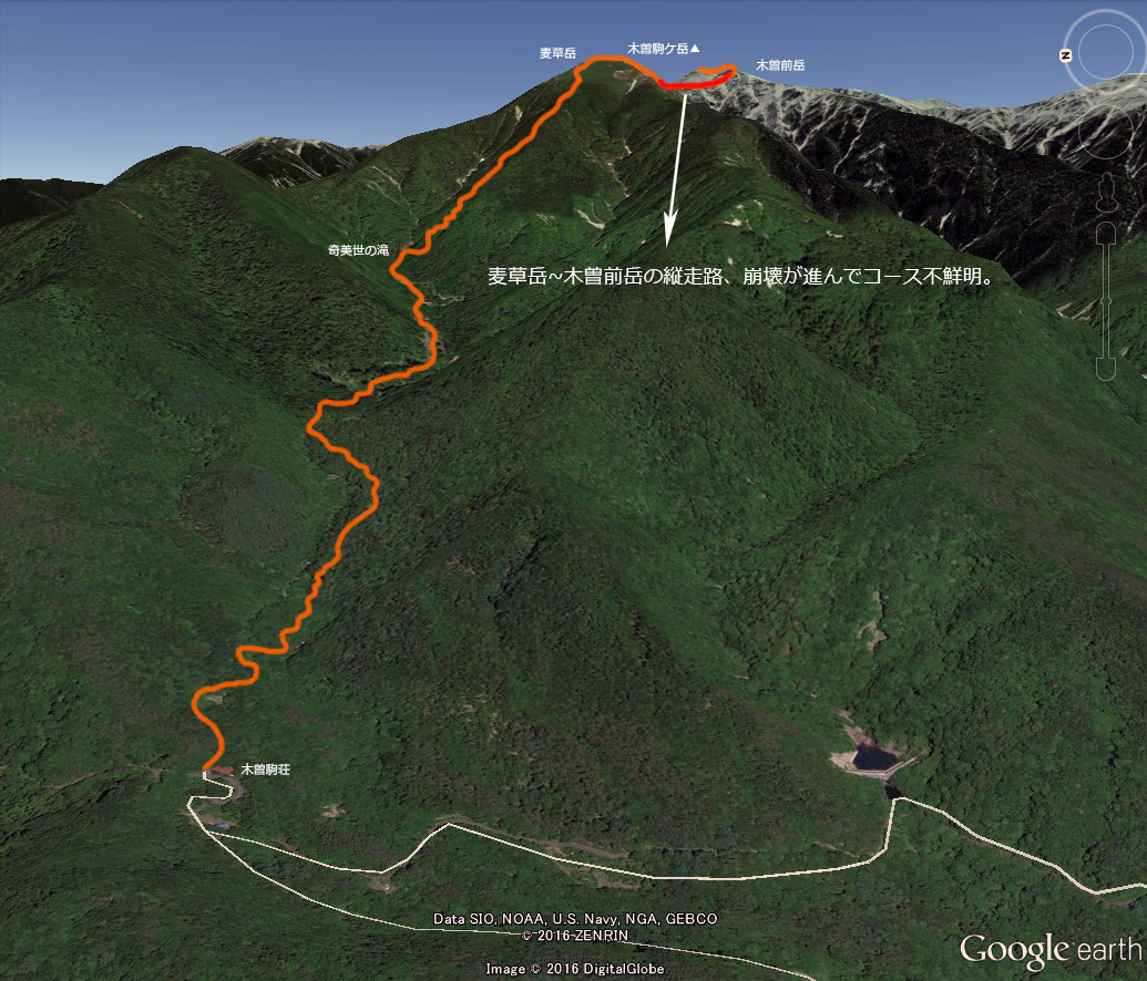
| Agematsu Course B for Mt. Kisokomagatake This route starts from Agematsu Sta., proceeding through the Ashijima Area, then up Mt. Mugikusadake to the peak of Mt. Kisokomagatake via the traversal of some other peaks. Compared to Course A, there are fewer climbers. However, the dynamic views of Kibiyo Falls that appear on the way are superb, meaning that there are some admirers of this route. Kisokoma Hut at the trail entrance is the center of the “Kisokoma JOY” project for renovating huts. Many climbers take the forest road from Kisokoma Hut to Kibiyo Falls. There are some collapsing points on the forest road though, where you should use a bypass trail. From Kibiyo Falls, it gets steep, just like a normal mountain trail. Soon after you get above the tree line, the view expands, and the hilly summit of Mt. Mugikusadake appears before you. From Mt. Mugikusadake to Mt. Kisomaedake, you climb the ridge. This part is especially difficult to pass, even for experienced climbers, because of some extensive collapsed sections. Watch your step very carefully. |
 |
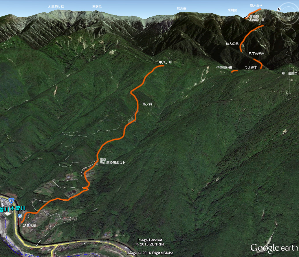
| Mt. Utsugidake Course This route climbs to the famous southern peak of the Central Alps, Mt. Utsugidake, starting from Kuramoto Sta. up to Umanose through Nakahatcho Pass, a long hike of more than 10 km. From Kuramoto Station, you walk through a residential area. Then you will find the box for submission of your mountain climbing plan. From there, you have to climb up all the way to Nakahatcho Pass. As you go down from the pass, you move from Agematsu Town into Okuwa Village. The path leads you to a forestry road until Usagidaira where some climbers bivouac to recover. From Usagidaira, you have to climb on a steep path. With Mt. Higashigawadake on your right, you aim for Kisotonokoshi ridge. “Kisotono” refers to the samurai general Yoshinaka Kiso of 12th century, who is said to have crossed the Central Alps over this ridge. Here stands Kisotono Mountain Hut, the last hut before the peak. From Kisotonokoshi to Mt. Utsugidake is a rather short distance. The route from Mt. Utsugidake to Mt. Kisokomagatake is along the ridge, taking even an experienced climber about 6 hours. |
 |
![]()
About Mt. Kazakoshi Mountain Trail
| Mt. Kazakoshi is a typical Satoyama (an inhabited mountainous area). It used to be tightly associated with communities such as the Yoshino Area at its foot. It was their precious resource for living where they could get grass for their livestock, roofing material, or food. The history has been traced back to ancient times, and some earthenware and stone tools were excavated in this area. When you visit the Yoshino Area, you can see Mt. Kazakoshi, which looks as if it is guarding this peaceful rural village. This mountain and its periphery are counted among the 8 best views of Kiso in the Edo Period, celebrating the beautiful grass fields of summer time with a pleasant wind softly caressing them. However, as modernization proceeded in this area, the grassland started to reduce with less human engagement with the mountain, resulting in the loss of the scenery. Now, the grassland area only remains at the top, leaving the other parts covered with miscellaneous bushes. |
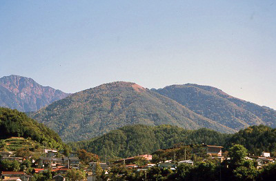 |
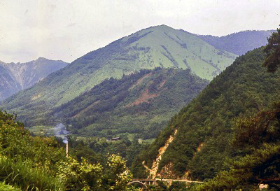
| Mt. Kazakoshi used to be covered with grass fields until around 1965. The residents once tried to get back to the old beautiful landscape. (Photo Top: Current Mt Kazakoshi) (Photo Bottom: Mt. Kazakoshi in 1960-75) |
 |
Trail Map Course B Course B bypassing on the right side of the mountain is currently in the process of development. Course A, that climbs vertically to the top, is rather bushy. On the slope, a cable that was used to convey trimmed grass or wood is still in place, so watch your step. *Hunting is permitted from Mid-November to Mid-February. For your own safety, please refrain from climbing during this period. |
 |
![]()
Mountain Scenery
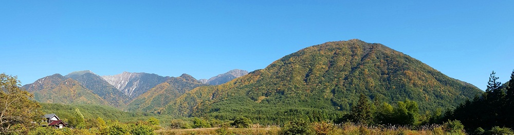 Mt. Kisokomagatake (left) and Mt. Kazakoshi (right) viewed from the Tori Area of Agematsu Town. The Yoshino Area is at the foot of Mt. Kazakoshi, on the right. |
|
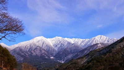 Mt. Kisokomagatake in December capped with snow, signaling the arrival of a severe winter. |
 Sunset time is a beautiful time to see the Mt. Kisokomagatake in the evening glow. |
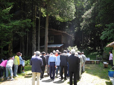 Stakeholders conduct the annual trail opening ceremony wishing for mountain climbers’ safety. |
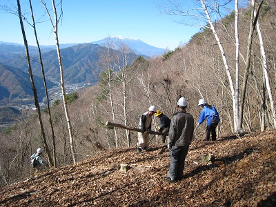 Resident volunteers clearing miscellaneous trees around the summit of Mt. Kazakoshi. |
 From the trail returning from Akasawa Natural Recreational Forest, you can enjoy dynamic views of Mt. Kisokomagatake. |
|
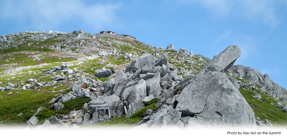
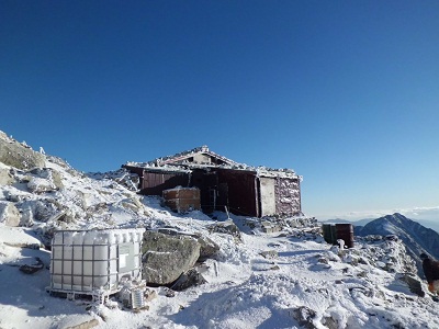 Winter arrives earlier than one expects in a mountain lodge. (Photo by Kiso Hut on the Summit) |
 The night sky is full of stars, just over your head. (Photo by Kiso Hut on the Summit) |
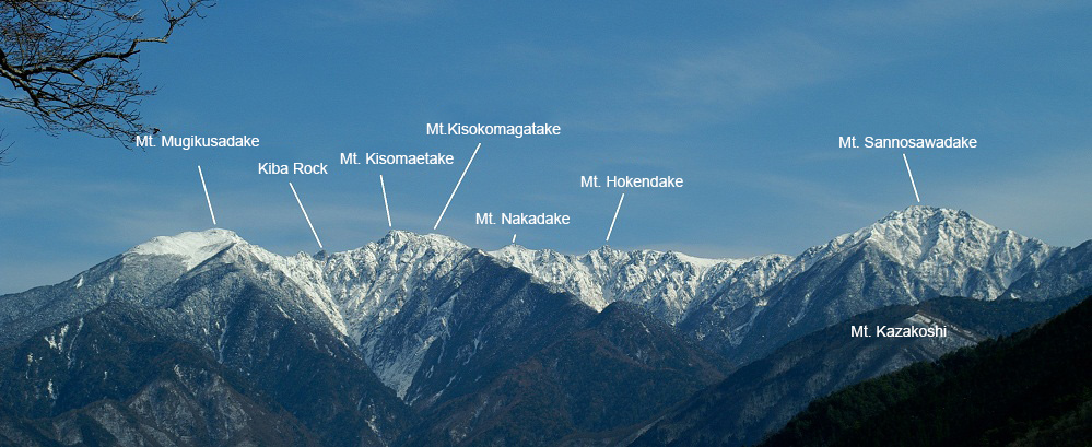
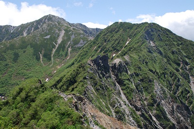 Viewing Kiba Rock, Mt. Kisomaedake, and Mt. Komagatake from Mt. Mugikusadake. Climbing along the ridge line is a difficult route. (Photo by Kisokoma Mountaineers Association) |
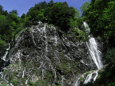 Kibiyo Falls at the third station of Agematsu Course B. The waters fall from a height of 45m and freeze into a green wall of ice in winter. |
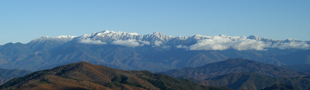 Viewing the Central Alps range from Mt. Hakkai of Mt. Ontake. |
|
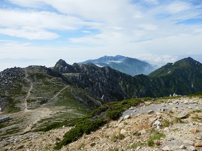 A view from the summit, in direction of Mt. Utsugidake. Most tourists use the Komagatake Ropeway to travel to the top. |
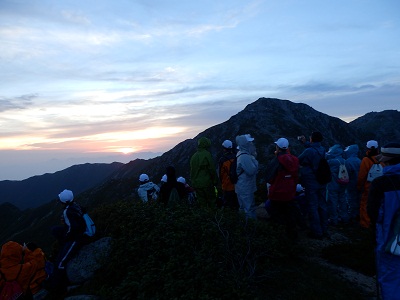 Second-grade students from Agematsu Junior High School. They watch the sunrise together, a good memory. |
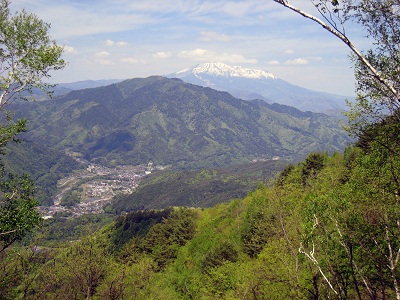 Viewing Mt. Ontake after climbing through the fresh green of Mt. Kazakoshi. You can also see the whole of Agematsu Town. |
|